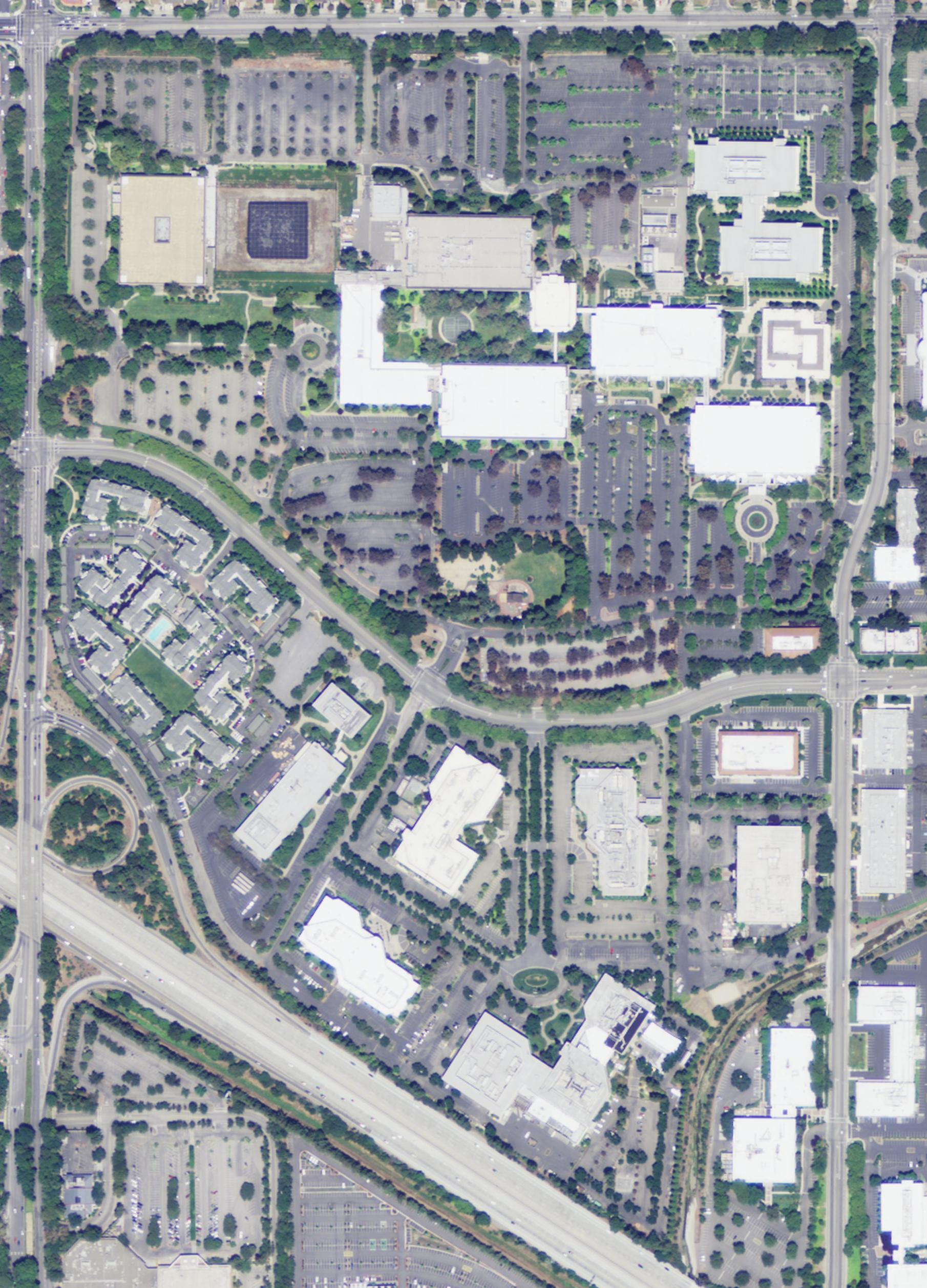
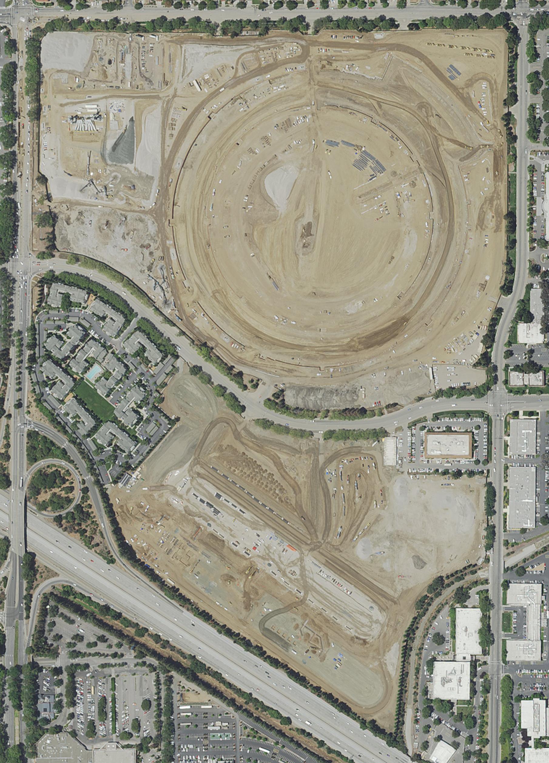
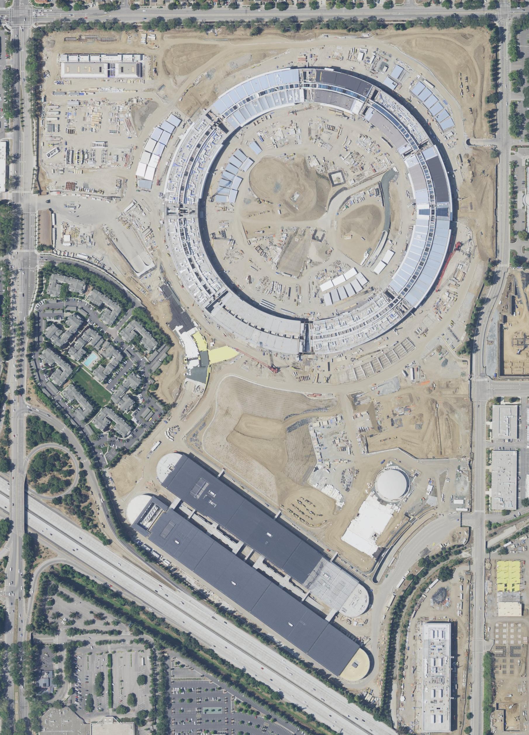
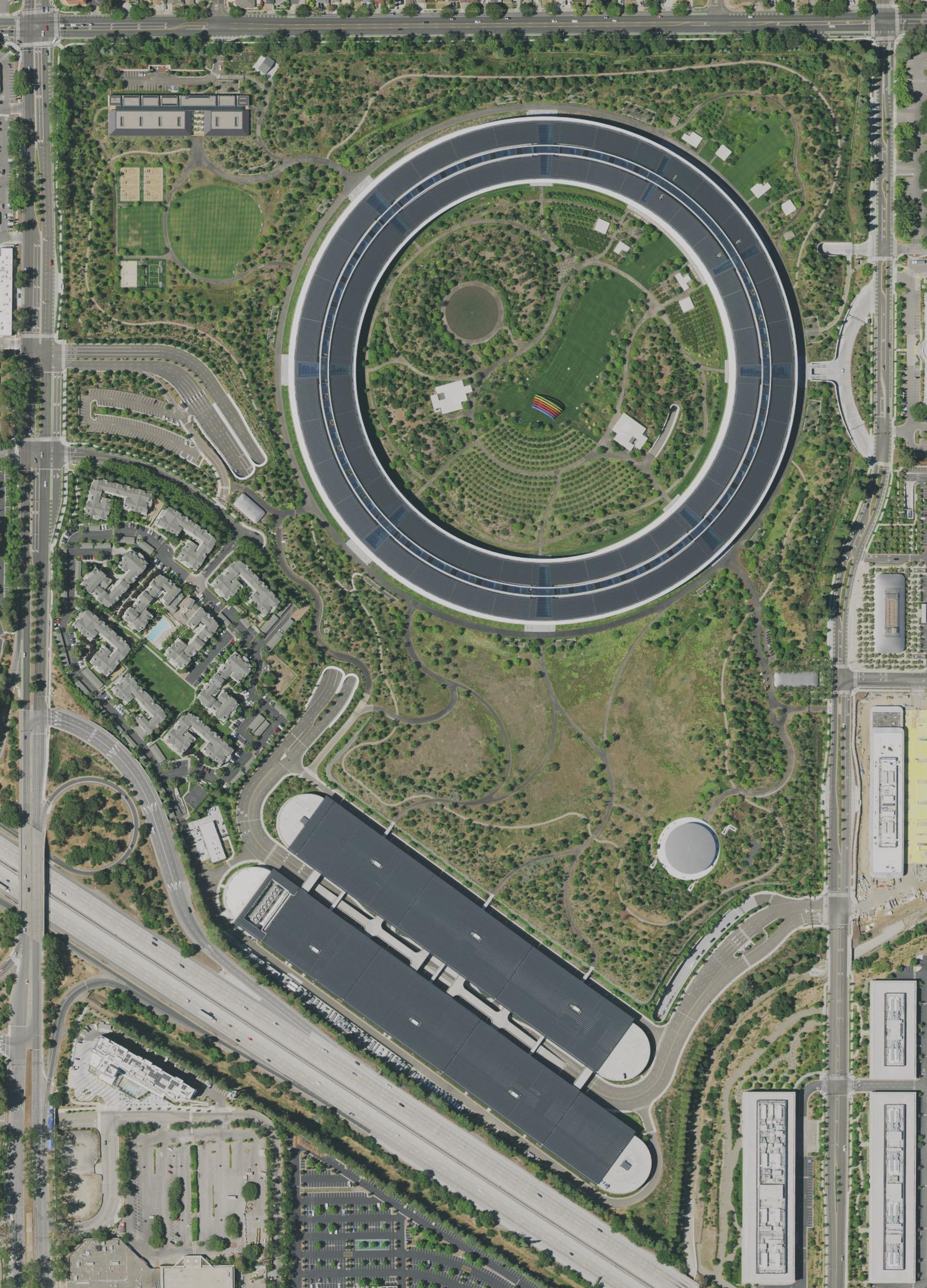
Seeing progress on the ground
High-resolution imagery of the world around us
Use directly or integrate into your products
More than 20 million GB of aerial and satellite imagery right at your fingertips.
Get imagery from above with transparent pricing and permissive licenses. Use it in your analysis, build derived products, download the data locally, or show it to your customers. We provide what you need.
Transparent pricing and simple setup, with permissive licenses to help you build what you want.
Transparent pricing and permissive licenses, to help you build what you want.
More than 20 million GB of aerial and satellite imagery right at your fingertips.

Covered by high resolution aerial imagery, and satellite imagery for the remaining part of the globe.
Ready to be explored by you and your customers. No more contract negotiations or licensing issues.
Always included in our Business plan, so you don't have to worry about hidden costs.
Use them for yourself, show them to your customers, or integrate them into your own products.
Use them internally or show them to customers. It's your decision.
We use interfaces already supported by a wide range of desktop applications and software libraries.
Create value-added services by using our analytics APIs, or by designing your own on top of the data.
There are no hidden limitations. You are welcome to provide data to your customers, and to download them locally.
Add a map or an analysis to your own application, and build your own services based on our APIs.
We use interfaces already supported by
a wide range of desktop applications and software libraries.
There are no hidden limitations. You are welcome to provide data to your customers, and to download them locally.
Create value-added services by using our analytics APIs, or by designing your own
on top of the data.
Add a map or an analysis to your own application, and build your own services
based on our APIs.
Use this token: wgFxq64q.PsBeXJV8f7iCArUZEGhVGM7GGd6XT0VH